
The Queensland Government has undertaken a review of the zoning plan for the Great Sandy Marine Park.
Each marine park has a zoning plan that outlines the rules to manage the multiple activities that occur within each park and defines the locations of different zones, which in turn provide for different levels of protection and use.
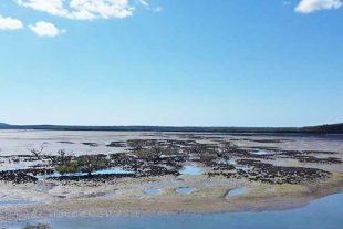
The Great Sandy Marine Park is a multiple-use park established in 2006 to protect its significant natural and cultural values, while providing opportunities for a range of different uses.
The review of the zoning plan for the Great Sandy Marine Park has now been completed.
The outcomes of the review resulted in a range of zoning and management changes that will be included in the final zoning plan.
The need for change
Globally, marine biodiversity is under threat from a range of factors including climate change, population growth, pollution and increasing use.
The Great Sandy Marine Park is being impacted by these global trends.
The Great Sandy Marine Park:
- Boasts 23 broad habitat types, however several of these are under-represented in the highly protected zones of the existing zoning plan, placing the marine park’s biodiversity and critical species at risk
- Has seen a significant decrease in its extent of seagrass habitat
- Is seeing a significant increase in mature marine turtle and dugong strandings resulting from a range of causes including boat strike, poor health and flooding
- Includes the only known gestation site on the east coast of Australia for the critically endangered grey nurse shark, however the existing zoning plan does not effectively protect sharks at this key aggregation site from being hooked or accidentally caught by recreational and commercial line fishers
- Is seeing a decrease in the numbers of many migratory shorebird species, some by more than 10 percent per year
- Is subject to increasing coastal impacts from severe weather events caused by climate change
- Is subject to a range of demands from competing uses.
The opportunity
The zoning plan review provided the opportunity to:
- Better protect cultural values, respect and recognise First Nations peoples’ native title rights and responsibilities for caring for their sea country
- Improve biodiversity and provide better protection of several iconic and threatened species, which are significant nationally and internationally including whales, dolphins, dugongs, turtles, grey nurse sharks and shorebirds
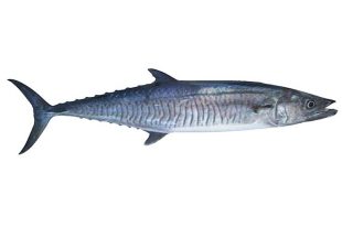
- Largely maintain the use of the marine park by the commercial trawl, crab, line and harvest fisheries, and those components of the net fishery that are of a lesser risk to threatened species
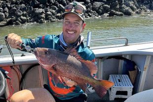
- Enhance the region’s enviable nature-based and recreational fishing lifestyle
- Support future economic growth in the region based on nature-based tourism, recreational and charter fishing and, where appropriate, aquaculture
- Assist local councils to address coastal impacts of climate change.
Outcomes
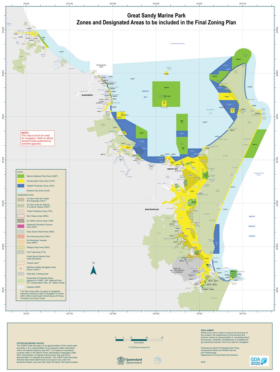
The final zoning plan will increase the Marine National Park green zone network, remove some forms of commercial net fishing in certain areas, improve threatened species protection and improve protection of cultural values.
Key changes include:
- Change in zoning to represent 12.8 percent of the area of the marine park in green zones contributing to a total of 28.6 percent of the marine park in highly protected green and yellow zones
- Removal of commercial large mesh gillnets and ring nets – operating under N1 and N2 fishery symbols – from the Conservation Park zones within Baffle Creek, Elliott River, Burrum River system, the Great Sandy Strait and Tin Can Inlet
- Measures to increase protection of threatened species, including shorebirds, turtles, dugongs and grey nurse sharks
- Measures to protect cultural and amenity values
- Zone changes to facilitate local government responses to increased coastal erosion from climate change impacts.
Implementation
As at July 2023, following the completion of the review phase, there are several steps required to finalise the Great Sandy Marine Park Zoning Plan.
Next steps:
- A commercial fisheries impact mitigation package will be developed and implemented to assist the commercial fishing sector and post-harvest seafood businesses directly affected by these changes
- Processes will be finalised to legislate the final zoning plan
- Community education to prepare marine park users for the commencement of the new zoning plan
- The final zoning plan comes into effect in 2024 following implementation of the impact mitigation process
- Ongoing implementation of a regional economic enhancement package that will include infrastructure such as boat ramps and artificial reefs to support recreational fishing and tourism opportunities in the marine park – further opportunities to explore the expansion of aquaculture in the region will also be investigated.
Community awareness
In the lead up to the final zoning plan taking effect, there will be public education and awareness programs to help support marine park users understand and prepare for the new zoning plan.
Read the summary of the outcomes that outlines what changes to expect when the final zoning plan comes into effect, or read the Decision Regulatory Impact Statement for full details.