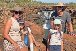
Hi all, travelling Queensland during the pandemic has been a special experience, mainly due to the lockdowns that have kept many southern travellers from their winter pilgrimages to western Queensland and the northern regions. The vast openness of our state is accentuated when the roads feel a little more isolated than usual. I feel so blessed to be living in Agnes Water and without the restrictions and lockdowns we so often hear about. Porcupine Gorge
With that said, let’s get back to travelling through Julia Creek, Richmond and a side track we had planned to take out of Hughenden to a place we’d heard of called Porcupine Gorge. It’s an easy trek of about 60km from Hughenden to the 5410ha Porcupine Gorge National Park. The park has a limited number of campsites, so booking a spot through Queensland Parks and Wildlife Service is essential. Porcupine Gorge
Standing at the lookout viewing the endless savannah, you contemplate how one small creek can carve such an impressive gorge. The action of nature over millions of years leaves me feeling quite insignificant, particularly when you consider the small amount of time we are on this planet. You will need to have a reasonable level of fitness to undertake the track to the bottom of the gorge, but the reward is to find yourself in a timeless landscape that has been untouched. Porcupine Gorge
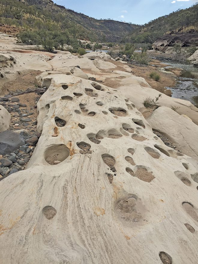
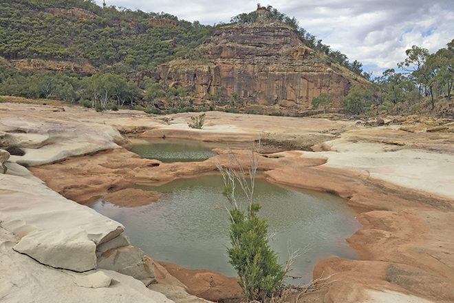
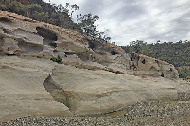
For me, there was a strong connection to the land and this feeling can be so overwhelming and spiritual. You will see a rock feature called the Pyramid as its stands proudly over the permanent waterholes below. In times of good rain, the creeks flow and the water carves natural sculptures with smooth flowing lines into the sandstone cliffs.
The flowing water drives tiny pebbles in circular motions to carve round holes into the sandstone giving the landscape an eerie feeling.
You can look all around and see various sized craters that nature has slowly created. Even in winter the temperature here can be warm, so I suggest carrying extra water for the return trip up the slope. QPWS have done a fantastic job in making the steep track to a safe standard and though it is only 2.4km to the bottom, it can be a tough walk up, particularly if you’ve spent time exploring and walking around the bottom of the canyon.
Keep in mind those waterholes make the ideal spot to have a swim and cool down while washing away dust from the track. The actual camp area is known as the Pyramid camp site and it has a number of facilities such as a few picnic tables and a non-flush toilet. There is a day users car park for those who wish to walk the park and head to Hughenden for accommodation.
The camp sites are numbered and allocated when you book through QPWS online. The sites are well-sized, so you’re not cramped into a small confined spot with neighbours within talking distance. Campfires are permitted, which makes for a fitting end to a day exploring.